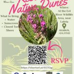
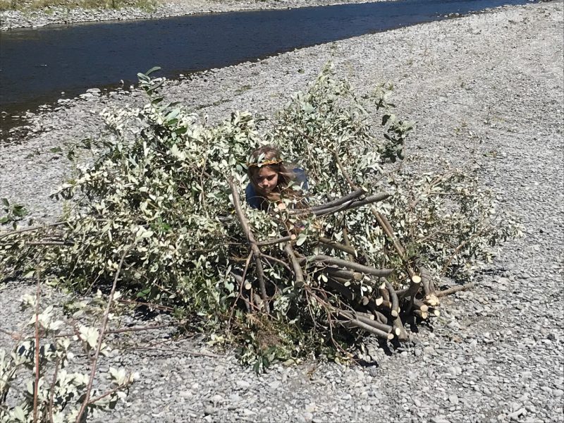
Creating floating shade structures for Juvenile Salmon June 6, 7, & 8th, 10am-3pm
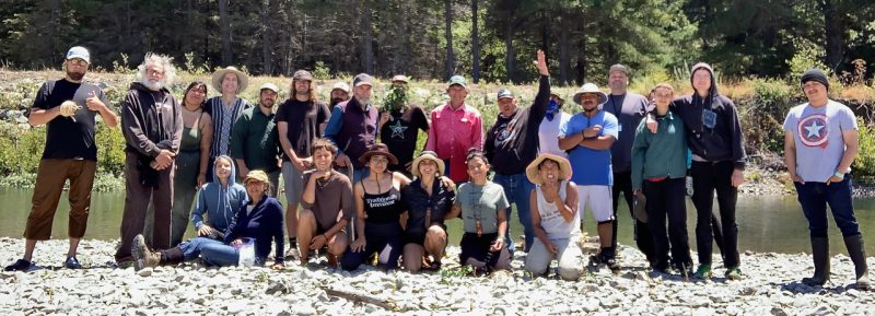
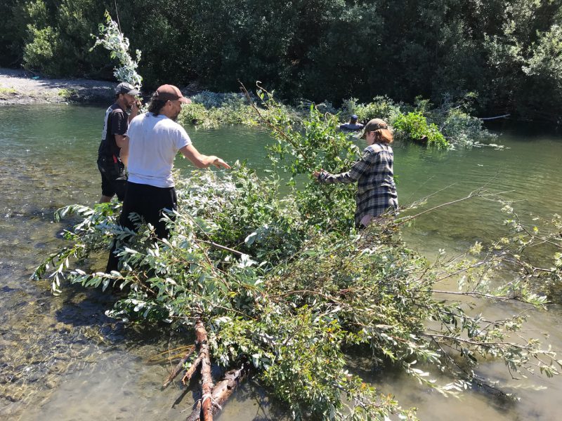
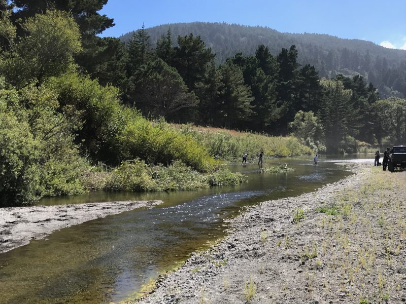
The Bear River Band of Rohnerville Rancheria and the Mattole Salmon Group are hosting a salmon restoration event for fish lovers of all ages – the creation and placing of floating willow structures to provide needed shade and cover for young salmon as grow in the lower Mattole River near the ocean. The young Chinook and steelhead spend their summer in the estuary area waiting for the mouth of the river to open in the fall so they are larger and more able to survive predation in the wide Pacific. This year the event is co-hosted with the Bear River Band of Rohnerville Rancheria.
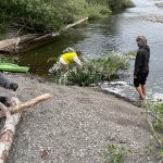
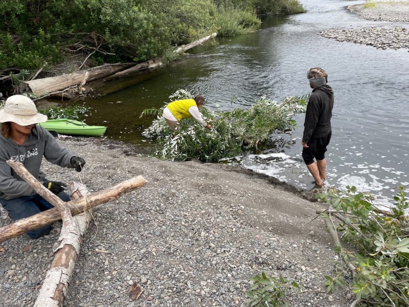
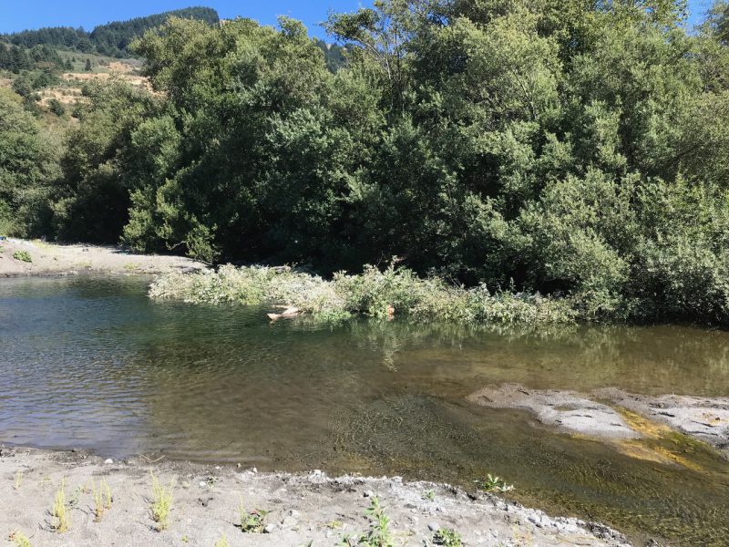
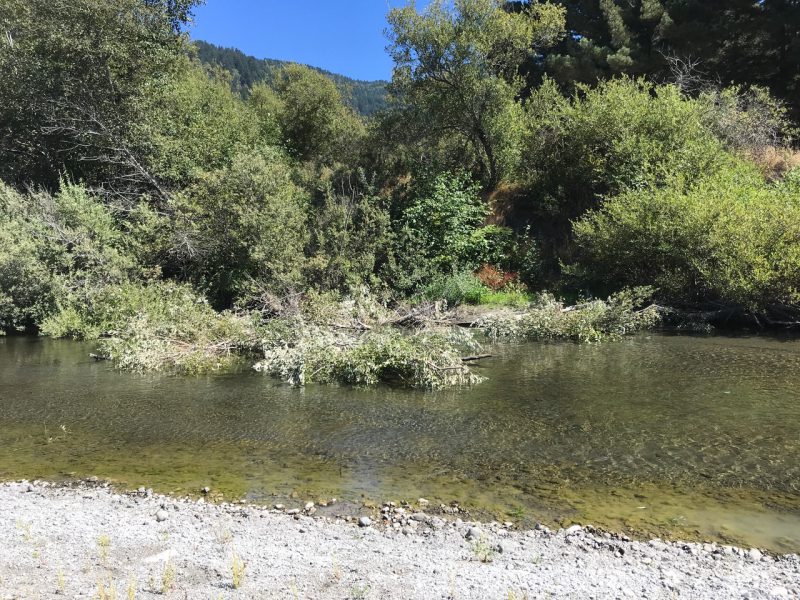
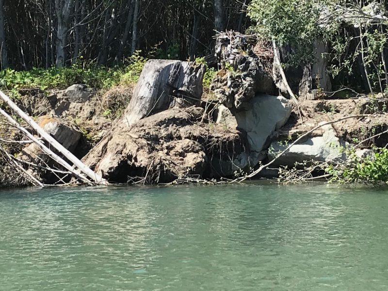
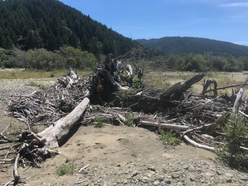
The Floating Shade Structures are made by lashing 4-8” diameter dry driftwood, available on the gravel bar, into triangles using sisal twine. They are floated next to a bare bank. 6-10’ long willow cuttings from the bountiful native willows in this area are harvested and placed in the floating triangles so that the cut end is under one side of the float and extend down 2-3 feet, while the leafy sections lap over the float and arc over into the water. The stems begin to send out roots and provide underwater structure which juvenile fish use to avoid predation and from which they can dart out to feed. The top leaves remain green, provide shade while dipping into the water creating more structural habitat.
Participants from ages 6 to 80 have come together for this event over the past 35 years. Families are especially invited.
Bring swimsuits (although not everyone has to be in the water), towels, warm layers in case of wind, work gloves, sunscreen. The organizers will provide lunch and snacks, snorkles and masks to see the fish flock to the structures as soon as they are placed, loppers, twine and all materials needed.
The work site is found about 3 miles west on Lighthouse Road, Petrolia. There will be salmon signs to show you were to go. Lighthouse Road leads to the King Range Conservation Area Mattole Campground and is on the southern end of the Mattole Bridge near Petrolia.
Your ticket purchase enrolls you in the continuing restoration and protection of the Mattole’s wild native salmonids. Participation not only offers a chance to win, but supports our ongoing mission to restore the Mattole’s native fish to self sustaining levels.
Buy a ticket for the Mattole Salmon Group’s first Raffle for the Fish! Win the use of a select and private launch site with comfortable overnight accommodations during the 2027 fishing season! Or a piece of the finest outdoor gear available for cold outdoor sports.
The Mattole River is unique in California being remote with no dams and no hatcheries. Each ticket you purchase directly contributes to our ongoing efforts on behalf of this river and its native salmonids.
Event date and time: Arts Alive, Saturday April 6 from 6pm to 9pm
Location: Humboldt County Visitors Bureau, 422 1st St, Eureka
Event organizer: Humboldt Area Peoples Archive
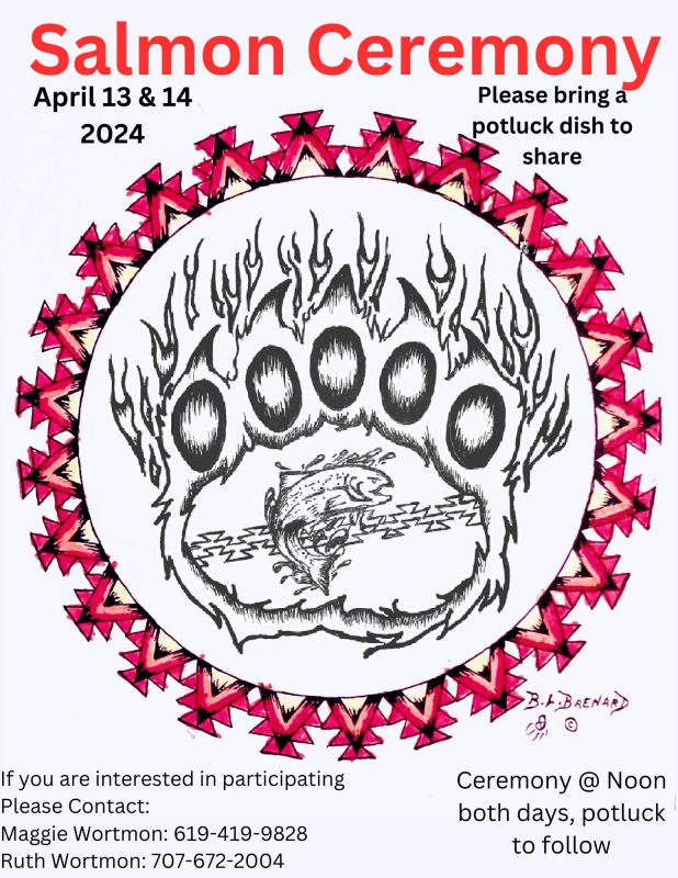
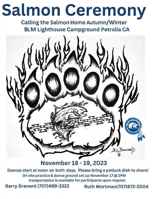
The Humboldt Area Peoples Archive announces the grand opening of its exhibit Salmon Ceremony Oral Histories at 6:00PM, April 6th at the Humboldt County Visitors Bureau at 422 1st St in Eureka. This exhibit invites visitors to delve into the intricate interplay between activism, environmental stewardship, and cultural collaboration. The evening will commence with special speeches by Nicole Riggs, Executive Director of the Humboldt Area Peoples Archive, and Ruth Wortman, Cultural Coordinator with the Bear River Band, promising an unforgettable experience for all attendees. This exhibit explores the revitalization of the Salmon Ceremony by the Bear River Band at the mouth of the Mattole River in Petrolia. The Bear River Band consists of seven federally recognized tribes: Wiyot, Nongatl, Whilkut, Sinkiyone, Lassic, Bear River, and Mattole.
The exhibit includes the voices of Ruth Wortman and Barry Brenard, Cultural Coordinators for the Bear River Band, speaking about the meaning of the Salmon Ceremony which existed for generations before falling away in 1958 during the termination era. In recent decades, the Bear River Band has taken steps to revitalize its culture.
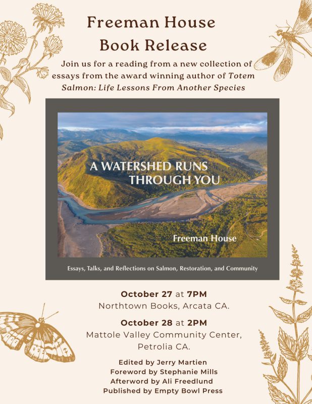
Since 1980, the Mattole Salmon Group, a local environmental nonprofit, has been working in the river to restore salmon habitat and populations which were negatively impacted from exploitative land management. They realized early on that in order to bring the salmon back from the brink of extinction for all peoples, there was a need to combine the spiritual connection of the indigenous people with Salmon together with science-based habitat and population enhancement activities they conducted.
In 2021, a collaborative effort developed between the Bear River Band and the Mattole Salmon Group, leading to the revitalization of the Salmon Ceremony. Every year in the fall, wild Mattole chinook and coho salmon migrate into the river to spawn when the river breaches the sand bar, generally in November. In April, steelhead salmon come in to spawn. At both times, juvenile salmon make their way into the ocean to mature for several years. Both events are celebrated in the Bear River Band Salmon Ceremony.
The Humboldt Area Peoples Archive developed the interactive exhibit in collaboration with the Bear River Band, Stacy Schaefer PhD, Ai Iwane, the Mattole Salmon Group and the Humboldt County Visitors Bureau. The exhibit will be open to the public Tuesday to Friday 12PM-4PM until the end of June at the Humboldt County Visitors Bureau, 422 1st St in Eureka. The Humboldt Area Peoples Archive (HAPA) collects, preserves and makes accessible the histories of counterculture and back-to-the-land in Humboldt and Northern California from the 1960s to now. Learn more at https://humboldtareaarchive.org/
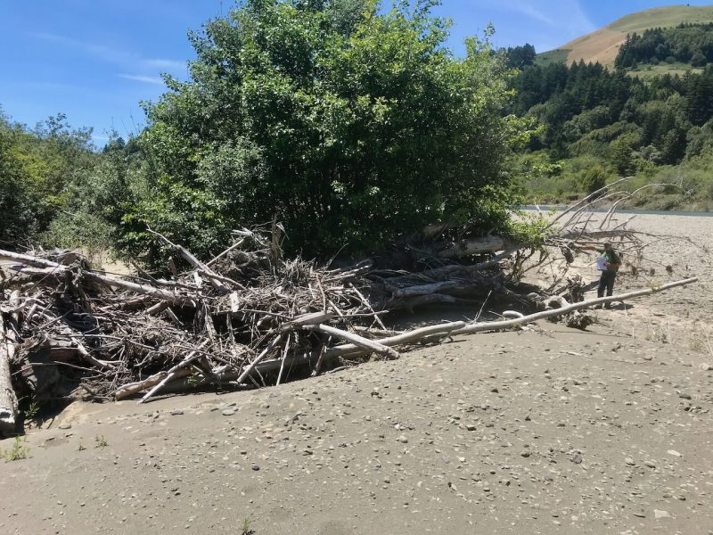
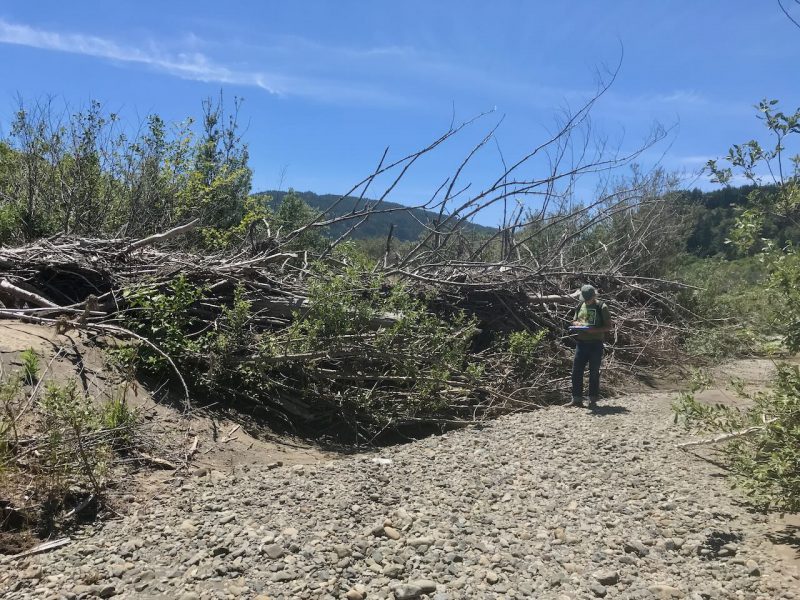
The Mattole Salmon Group and the Bear River Band are assembling driftwood and willow structures this Saturday, August 26, 2023, at 10 AM to help protect juvenile salmon hanging out at Stansberry Creek. Come join us – no special skills needed. If you have loppers bring them to cut 1” willows shoots.
For more information, call 707-eight three 4 – five 34 zero.
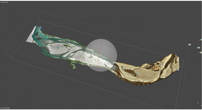
This year’s topographic survey was completed using Photogrammetry and a sUAS (aka Drone). We achieved an excellent absolute accuracy using this process along with about a dozen RTK surveyed Ground Control Points (thank you Conor Shae of the USFWS). In addition to a much more accurate survey, we also reduced costs as compared with a more traditional total station survey like we did in the past. The Estuary is ideal for drone mapping missions as the terrain is fairly flat and open. A total of nine flights at 300 feet altitude AGL (Above Ground Level).
We conduct surveys as often as possible to collect the following data:
Topography of the estuary
LWD survey to identify large wood placed with a helicopter in 2013 & 2016
All placed wood had pit tags installed so we are now able to scan those tags to identify pieces of wood and track their movement
Bathymetric survey to identify pools and collect pool data
Download the Draft Final Report
A draft report was completed and is available for download here.
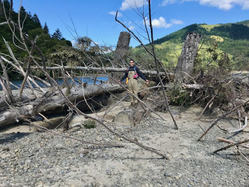
Josh Madrone standing on back side of Woodzilla2 in June 2019. Several feet of gravel has been deposited here, burying multiple logs and 5 ton boulders.
Overview and Intent of Proposed Action
Restoration of fish habitat in the Mattole River estuary requires a comprehensive multi-year approach. The approach presented here is driven by a set of biological objectives, which, in turn, are controlled by various physical processes at work in the lower Mattole River.
The biological objectives of this effort are to:
Improve juvenile salmonid survival during summer, low-flow periods
Increase availability of suitable winter rearing habitat, with emphasis on juvenile coho salmon winter refuge habitat.
To accomplish these objectives, this five-year strategy seeks to integrate our understanding of the dynamic nature of the lower river by identifying a suite of physical river features for treatment.
The intent of these treatments has several physical objectives:
Increase channel stability in the lower Mattole River
Increase instream habitat complexity
Promote riparian vegetation colonization and growth
Create a mosaic of varying streambed sediment sizes
Promote more variable topographic diversity in the reach
Increase connectivity to existing sloughs, alcoves, and other off-channel habitat
Increase stream nutrients available to native species
Finally, recognizing the dynamic setting of the lower Mattole River and our ever-improving understanding of riverine processes, the proposed action is intended to be adaptive. The adaptive elements of the plan are described in detail at the end of the proposed action section.
Three specific types of projects are proposed here: placing structures on islands; installing structures at the apex of river bars; treatments along the margins of river terraces; and re-connecting a slough channel to the estuary. The specific treatment locations and types are described in detail below.
Monitoring Background
This follows monitoring work done in 2014, summer 2017, and now again in summer 2019. The 2019 survey was completed by Josh Madrone and Sungnome Madrone. A drone was used for topographic and bathymetric information combined with ground surveys of pool length, width, and depths, and locations of large wood/whole trees.
Previous Surveys
The two previous surveys were done by Total Station ground surveys, to survey features such as large wood/whole trees, stream barbs, structures, pools, and major topographic breaks. The 2014 survey was completed by Keith Barnard, Sungnome Madrone, and ________________. The 2017 survey was completed by Keith Barnard, Sungnome Madrone, Josh Madrone, and Brandon Madrone.
Survey Dates
The 2014 survey was completed in October, between the 7th and 30th. The flow at time of getting pool data was ~20 CFS. In 2017 we surveyed once around the 19th of May and again on the 1st of June. The flow at that time was between 240-380 CFS. In 2019 we surveyed on June 7th and again on September 13th. Pool data was collected with a flow of ~35 CFS.
Table 1. Survey dates and river flow
Year
Survey dates
River flow (CFS)
Comments
2014
October 7
20
Pools
October 30
110
LWD
2017
March 13-14
1200
LWD
May 17-19
400
Pools 1-16
June 1-2
250
Pools 17-19
2019
June 7
340
LWD
September 13
35
Pools 1-14 (all)
Report Focus
This report will focus on the monitoring results from the summer 2019 survey for tree locations after 3-6 years of flows and rearrangement of large wood, as well as the location of pools in this lower river reach/estuary.
UAV Mapping (Photogrammetry)
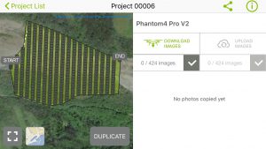
Photogrammetry is the science of obtaining reliable measurements from photographs and digital imagery. The 2019 aerial imagery was collected with an Unmanned Aerial Vehicle (UAV) – DJI Phantom 4 Pro v2 – with a 20 Megapixel camera, flying ~300 ft Above Ground Level (AGL). The resulting photos were processed in Agisoft MetashapePro v1.6.0 to create 3D spatial data to be used in GIS applications. The two primary outputs that were created and exported are a georeferenced orthomosaic, commonly used in geographic information systems (GIS) as a “map accurate” background image, and Digital Surface Model (DSM), which gives you the height of the objects that are on the surface of the earth. These files are saved in the most-GIS-compatible GeoTIFF format. Ground Control Points (GCP) were surveyed with RTK GPS by Connor Shae of USFWS, which were used in the reconstruction of the model, with a few saved for check points to measure the accuracy of the finished model.
3D Model in Agisoft MetaShape Pro
This year’s topographic survey was completed using Photogrammetry and a sUAS (aka Drone). We achieved an excellent absolute accuracy using this process along with about a dozen RTK surveyed Ground Control Points (thank you Conor Shae of the USFWS). In addition to a much more accurate survey, we also reduced costs as compared with a more traditional total station survey like we did in the past. The Estuary is ideal for drone mapping missions as the terrain is fairly flat and open. A total of nine flights at 300 feet altitude AGL (Above Ground Level).
A draft report was completed and is available for download here.
Treatments Implemented
In Fall 2013 and again Fall of 2016 hundreds of whole trees were put into the estuary. Details are included in the Final Reports for those projects.
The 2016 helicopter wood placement component for this 2016 work included the following numbers of whole trees placed:
Table 2 – 2016 wood placement stats
Area L-1
12 pcs
Area L-2
9 pcs
Area R-1
9 pcs
Area R-2 and R-3
31 pcs
Area R-4
22 pcs
Area R-5
11 pcs
Woodzilla 2
9 pcs
Total
103 pcs
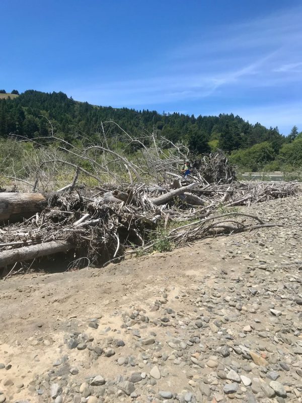
A total of 103 pieces placed in-stream, at terrace margins, or on the right bank (nearly all were Whole-trees, with boles and integral root wads). Plus, approximately another 150 pieces were delivered to the south-side terrace — to sites L-3 and L-4, located upstream from the 2013 project area — and subsequently used for stream barbs (small to medium-sized trees, some without root wads). Trees were tipped on-slope with an excavator and placed in the river by helicopter. Total acres of riparian area treated was 20. Over 2000 15-foot long willow cuttings were planted in the deep trenched baffles.
We constructed 30 stream barbs with 160- 60 to 80-foot-long trees that were 16-36” in diameter with root wads and limbs. The total trench length was 2740 feet with 3,340 willow cuttings 15- 20 feet long and multi branched. The stream barbs treated 2010 feet of stream bank. This approach uses a bio-technical terrace margin treatment designed to increase bank resistance to erosion. The trenches were placed at about a 30-degree angle downstream with the flow and about 50-70 feet apart. The trenches were excavated 15-20 feet deep to the summer water table so that the cuttings were placed in water immediately after being cut. After backfilling the trenches, the area was regraded and mulched.
Monitoring Program
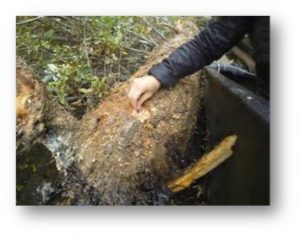
After tree placement was complete, the Mattole Salmon Group implemented a monitoring program to answer the question,” Which trees moved, under what size flows, and where.” This monitoring program involved placing a Passive Identification Tag (PIT) into each whole tree. A hole was drilled with a cordless drill at 4’ above root wad. The hole was drilled towards the center of the log, and at a depth to put the tag ½ inch under the cambium. The tag was inserted into the tree (see figure 5). Silicone calk was used to seal the hole and secure the tag. Trees with greater than 16” diameter got two tags, on opposite sides of the tree. Additional information was collected about size (total length and diameter at breast height (DBH), species and complexity for each tree and associated with the trees individual number. Using a total station all trees were marked in their orientation on the landscape.
The total station work gave us an as built map of the entire project site with one (1) foot contour intervals.
Two re-surveys have taken place since the project began. One in the spring of 2014, and another in the Spring of 2017. Re-surveys involve scanning the tree PIT tags and using GPS to locate each tree on the project map. This shows which trees have moved and to where. We used a total station to re-map terrain elevations after many significant high flows (over 25,000 CFS) during 2016-2017.
FIGURE 4 – A PASSIVE IDENTIFICATION TAG (PIT) TAG IS INSERTED INTO TREE 4’ ABOVE ROOTWAD
Large Wood / Whole-Trees
The 2019 large wood survey found 64 pieces of large wood.
However, the actual number is greater because there are multiple structures with multiple pieces of large wood in them, which were recorded as a single piece (eg. Woodzilla 2 structure is 9 whole-trees).
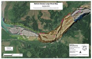
FIGURE 6 – MAP OF LARGE WOOD/TREE LOCATIONS IN SUMMER 2019
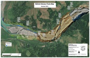
Pools
In 2012 there were 8 pools 3-5 feet deep in the treatment reach. After the placement of the 2013 and 2016 heliwood trees, and after high flows of 2016/2017, there were 20 pools that were 5-12 feet deep in the same reach. All pools were in close association with the placed heliwood.
In 2019 there were 14 pools that were 4-10 feet deep (see Figure 7) It should be noted that a more restrictive definition for pools was implemented in 2019, which if used in previous surveys would have resulted in fewer pools. One goal in 2019 was to standardize definition of pools going forward to be able to easily replicate in the future.
Pool Definition
For our purposes, Pools are defined as a small part of the reach with reduced velocity, little surface turbulence and deeper water than surrounding areas. To be considered a pool for this survey, the maximum depth at the deepest point was a minimum of 4 feet. Additionally, pools have the following characteristics:
a surface slope of 0%,
a hydraulic control,
a maximum pool depth >=4 ft, and
often form around boulders or large woody debris,
Table 3 – 2019 Pool Measurements
Pool #
Length
Width
Depth
Volume (ft3)
1
175
40
4
28,000
2
180
30
5
27,000
3
140
25
4.5
15,750
4
30
14
5
2,100
5
30
12
4
1,440
6
600
30
10
180,000
7
486
40
6
116,640
8
756
34
6
154,224
9
65
20
4
5,200
10
80
20
4.5
7,200
11
40
15
5.5
3,300
12
–
13
450
15
5.5
37,125
14
400
30
8
96,000
Total volume of pools (ft3)
673,979
Pool locations are shown in Figure 7. Full size maps are available on the file server as geo-referenced PDFs ready to print at full-resolution up to Tabloid size (11×17).
FIGURE 7 – MAP OF POOLS IN SUMMER 2019
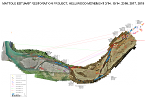
The final map (see figure 8) shows large wood as placed as well as movement between surveys. This is a draft copy of this map and will be replaced in final version.
FIGURE 8 – LARGE WOOD MOVEMENT MAP
Flight Mission Planning
My workflow involves a multi-step process using a few different apps. Flight mission planning and image acquisition is done with Pix4D Capture using a DJI Phantom 4 Pro V2.
Post image processing and dense point cloud are created with Agisoft MetaShape Pro. Final maps are produced using QGIS on a Mac.
Sample Flight Mission Plan in Pix4D Capture
Photo Gallery
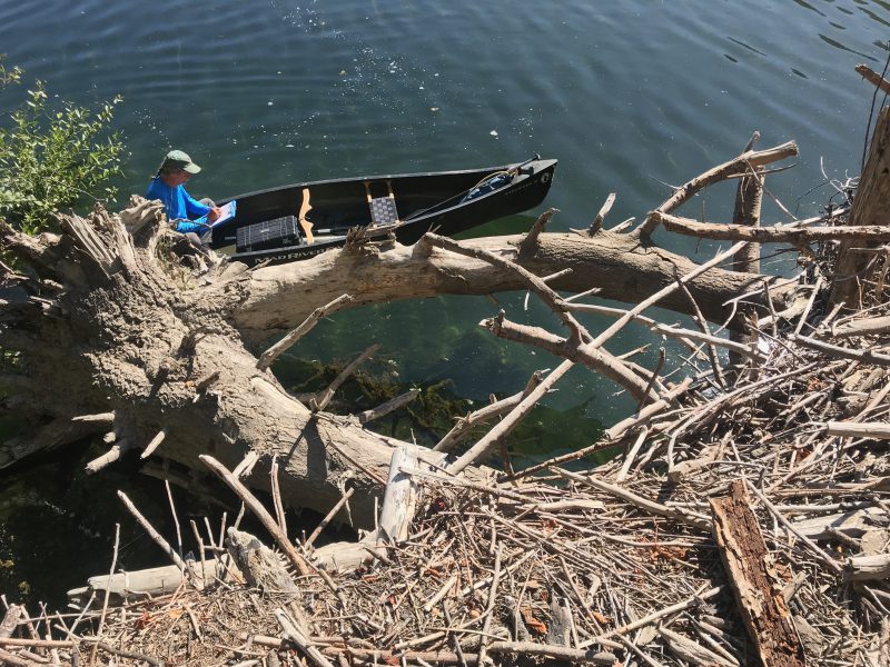
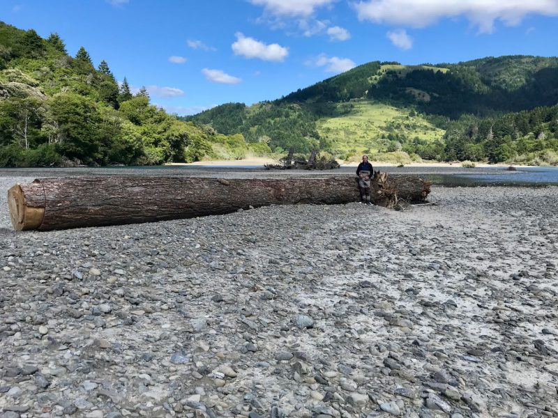
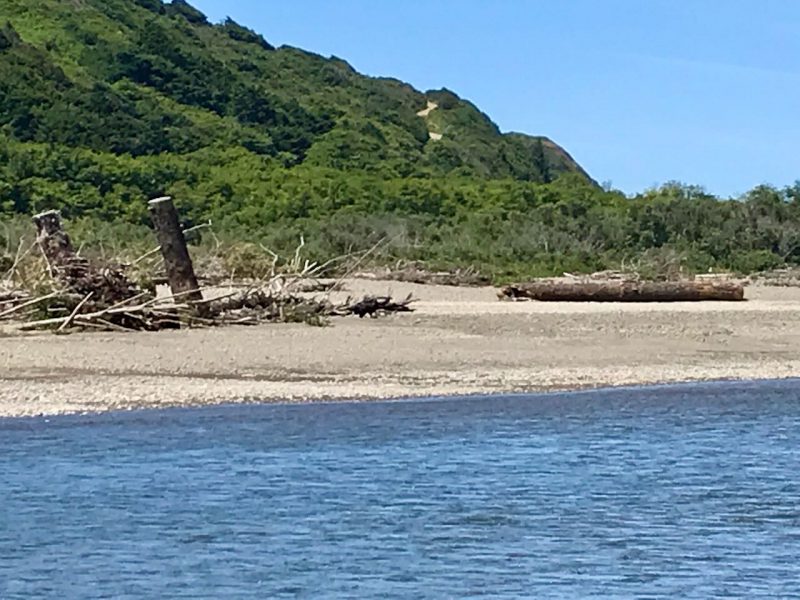
Sungnome looks very small standing in front of this massive log left on the bar near Woodzilla2.This massive Doug fir log left near Woodzilla 2 would make a great addtion to this structure.Standing about 50 ft away from the orignal Woodzilla structure while completing re-survey of the Estuary in June 2019.Josh Madrone standing on back side of Woodzilla2 in June 2019. Several feet of gravel has been deposited here, burying multiple logs and 5 ton boulders.Sungnome Madrone, standing at the top of a Heliwood tree, placed in 2016, that has been highly effective both in catching additional woody debris and showing signs of pool scouring and bar building.Lots of debris becoming snared on large Heliwood tree forming an Apex Jam over several yearsSungnome Madrone standing in front of a Heliwood Tree, placed in 2016, with a huge amount of additional entangled woody debris, fresh Willow sprouting, etc.One of the original Heliwood “Slug” trees hasn’t moved an inch, and has been collecting additional woody debris…
The Mattole Restoration Council is a 36 year-old watershed restoration non-profit on the Lost Coast of
Northern California, with a million dollar plus annual budget and a regular staff of nine. We are a
membership organization with an elected board of directors that undertakes landscape-scale watershed
restoration and rehabilitation in the Mattole watershed and adjacent areas, and promotes a stewardship
land ethic. For more information about our programs, please visit www.mattole.org.
Job responsibilities
Works with the board of directors to execute the mission and long-term strategic goals;
Oversees and manages 9 regular staff and 60 seasonal employees;
Leads fundraising efforts and works with the program staff to develop projects and submit grant proposals to various federal and state agencies and foundations;
Directs the implementation of organizational policies and the strategic plan;
Acts as liaison to the community, partner groups, agencies, and other stakeholders;
Oversees fiscal management.
Desired Qualifications
Excellent communication skills;
Experience with fundraising and developing federal and state grant proposals;
Experience with managing federal and state contracts;
Ability to establish dynamic relationships with a broad base of stakeholders;
Experience with non-profit fiscal and personnel management;
Commitment to community based watershed restoration;
A background in environmental science/biology/ecology;
Familiarity with watershed restoration strategies and methods;
Strong sense of self-direction and self-organization;
The position is full to half time (negotiable), and reports to the board of directors. Compensation is commensurate with experience, and includes health, vacation, training and retirement benefits. The position is based in the Petrolia office, with travel throughout the watershed and Northern California. A valid driver’s license and functioning personal vehicle are required.
To Apply: Email cover letter, resume/CV and three references to John Williams, jgwill@frontiernet.net. For more information, call John at 707 629 3265.